Georeferencing
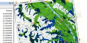
There is a wealth of information still trapped in printed maps, like these ones about forest cover in BC.
portfolio of projects
There is a wealth of information still trapped in printed maps, like these ones about forest cover in BC.
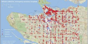
How well placed are emergency services in Vancouver? Are they near where car accidents frequently result in injuries or death? Are hospitals located nearby?
One of Vancouver's lowest areas is also a site of development. What is vulnerable to a storm surge in False Creek?
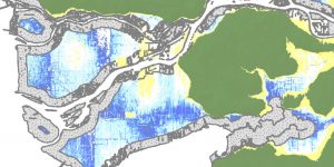
Vancouver already has seen significant flooding. With sea-level rise and greater storm surges from stronger weather patterns, the risk is only growing. These maps show major road length susceptible to flooding, and the flood risk of a planned hospital.
Maps highlighting the percentage and distribution of tenant households in Vancouver and Montreal show that both housing price and affordability for tenants are strikingly different.
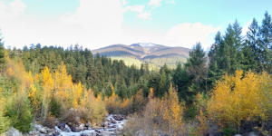
A resort at Garibaldi has been a dream of skiers and developers alike for a generation. The fish in the streams, mule deer and mountain goats have lived out their generations in peace that may soon be disturbed. Time has barely passed for the ancient trees they live among.