I asked myself, what do people in Vancouver fear? There is little violent crime, no serious earthquakes since 1750, no violent weather such as tornadoes, cyclones or proper blizzards, no venomous animals. But one way that people of any age might meet with unexpected trauma is through vehicle collisions.
While the City of Vancouver has made efforts to improve traffic safety, weather and error mean that there will always be collisions. Prevention is important, but so is response.
In this project, I mapped every vehicle collision resulting in injury or death (including pedestrians) from 2003 to October 2019. I then combined tables describing emergency response types and locations to be able to identify emergency services that could respond to vehicle collisions. I made a 1 kilometre radius buffer around each of them to find whether the areas which have the most collisions also have the most emergency services. They do not.
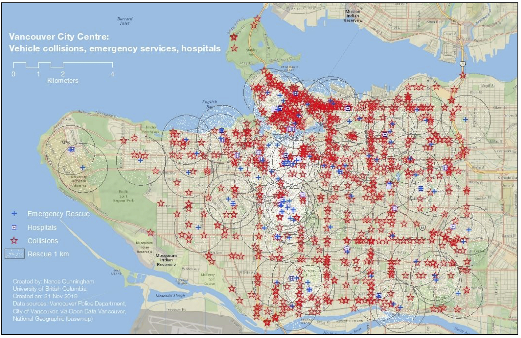 The area with the most collisions is in the downtown business core. While that is not the greatest density of emergency services, this analysis could show only the number of service sites, and not the capacity of each. Also, generally areas with high frequency of collision also had high coverage.
The only areas where collisions occurred more than one kilometre from an emergency response service were in Stanley Park, along some parts of Marine Drive, a few segments of Kingsway, and a few spots near the city limits. As accessibility to all these areas is not problematic, this does not raise immediate concerns. However, if further emergency services are established, this should be taken into consideration.
Emergency response can be critical for life-saving, but many of those injured in vehicle collisions will need treatment in hospital.
For hospitals, I took a two-kilometre radius, as most collision victims will have been stabilised by the emergency response.In this map, we see that almost all collisions happen within two kilometres of a hospital. The exceptions are again Stanley Park, some parts of Marine Drive, and some areas near the city limits. Here however we also see a band to the west of the city that is farther from hospitals. However, this is an area with little traffic congestion and good access to UBC hospital, so this is not a major concern.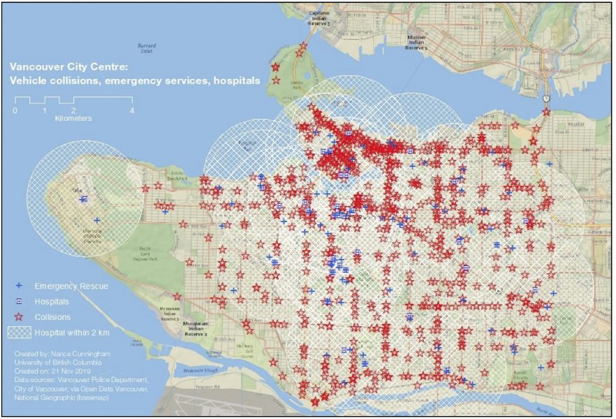
In this project I learned to:
• devise a research question that could be answered with GIS
• combine disparate data sources
• design maps to clearly show data