Vancouver, as a port city is vulnerable to rising sea levels. In this exercise, I learned how to re-classify a raster digital elevation model (DEM) and selectively buffer shoreline areas in order to identify the areas of Vancouver that are likely to be flooded by a storm surge.
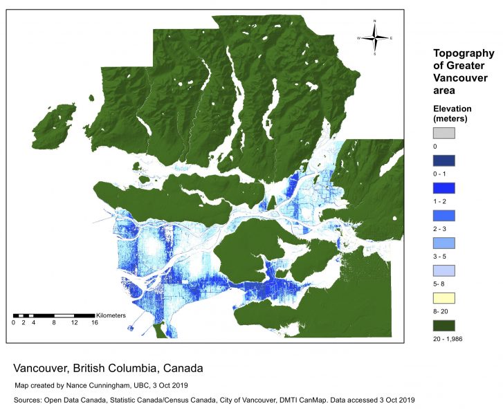
First of all I created a map that just picked out lower e
levations. In the map below areas below 5 metres in elevation are shown in blue, with darker blue indicating lower elevation. If there were long-term sea-level rise, these areas may be
underwater.
However, sea level rises only gradually, so a rise of several metres would take many decades. Of more immediate concern for the residents of Vancouver are storm surges. There have already been floods in Vancouver and other port cities of North America reaching 5 meters.
The next step was to locate areas which were both within one kilometre of a shore, and below 5metres in elevation, to identify the areas most likely to be affected by a major storm surge.
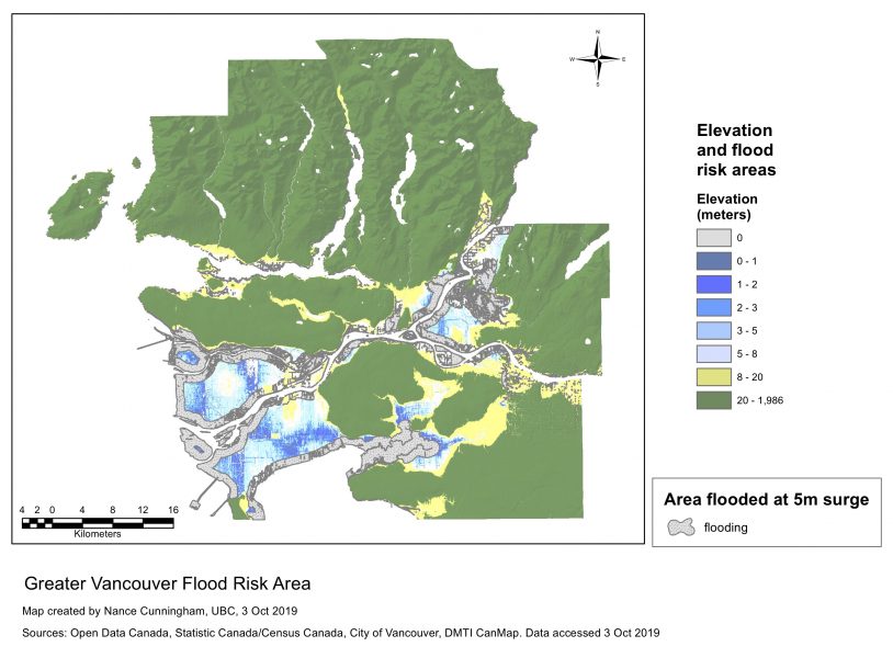
This taught me to convert a raster to a polygon, create buffers selectively in the low-lying areas, and and to show the intersection to find the areas that were both low and near shores.
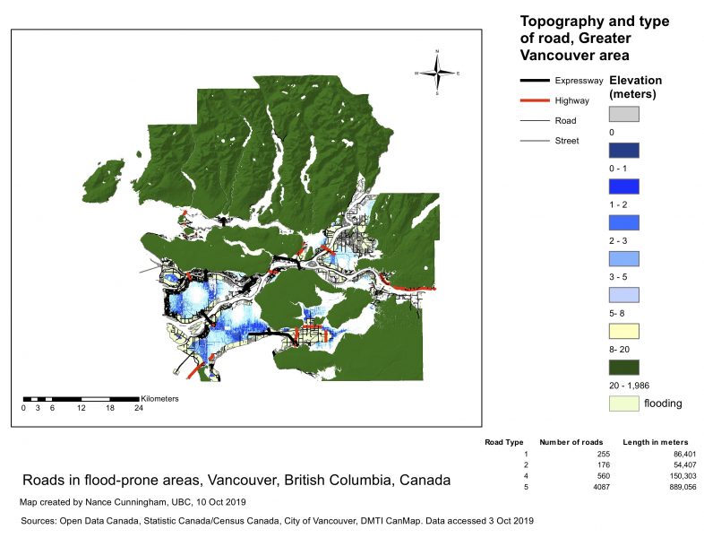
However, there were still two more questions of interest. First of all, if there is a flood, people need to get out fast. What roads are in the storm-surge area?
I added roads of different sizes to the map, showing them only in the areas likely to flood.
The final map shows road communications in the flood-prone areas.
In this activity, I learned how to:
• work with DEMs of different resolutions,
• re-classify raster data for analysis
• convert rasters to vectors
• create buffers selectively
• find the intersection of areas of interest